“This winter, we’ve gotten lucky, believe it or not, because things could have been significantly worse than they were,” he said. “It is possible to have years where there are multiple atmospheric rivers in a row that are much stronger than what we saw at any point this year.”
Swain said the recent storms dropped only about half the precipitation and less than a quarter of the runoff than in the “plausible worst-case scenario” he describes in his study. The resulting “megaflood” conditions, he said, would cause “widespread levee failures, and not just levees protecting primarily agricultural areas, but potentially levees that protect major urban areas.”
A KQED analysis of the National Levee Database found that only 10% of the nearly 600 levees in the greater Bay Area have a flood-risk rating. The small percentage that do include the breached levee on the Pajaro River, which is rated “moderate,” as is one on the Salinas River, which also failed, in January, displacing thousands. Other levees rated “moderate,” in more urban areas like San José, also are at risk of significant flooding.
“We’ve definitely gotten a taste in some areas of what a much lesser version of this would look like,” Swain said. “But we need to be preparing for and stress-testing our infrastructure for much greater events than the ones you’ve seen this year.”
Flood modeling
California is taking Swain’s predictions seriously by potentially funding a flood-modeling project — in partnership with Swain and the Oak Ridge National Laboratory — to gain a better understanding of the impact an extended series of extreme storms would have on existing infrastructure, like levees.
“This is a flood model that would resolve the flood risk at one corner of someone’s house versus another corner, for example,” Swain said. “That’s how detailed it would be for the whole state.”
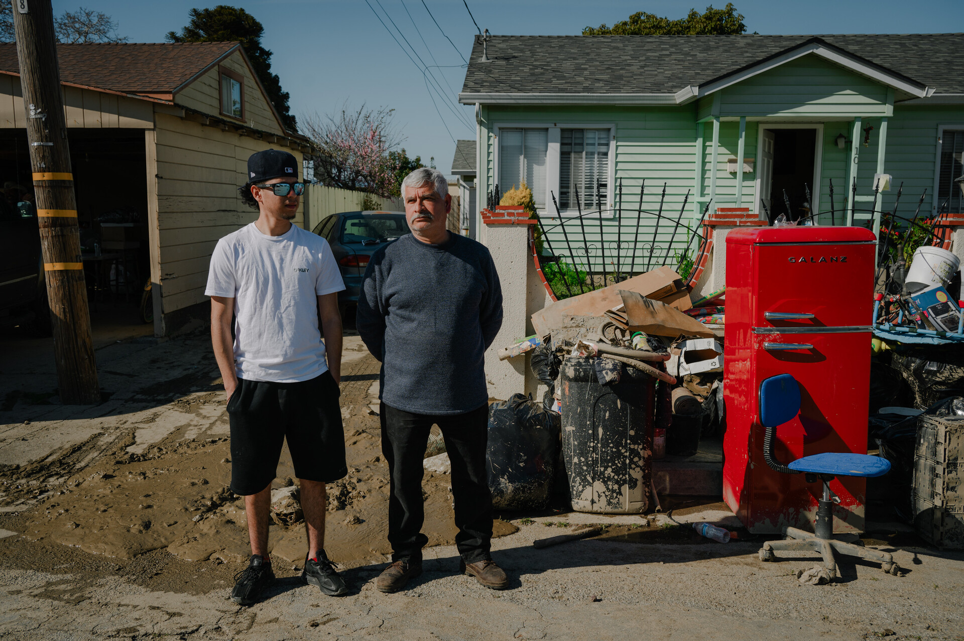
 Armando Alvarado, 22, and his father, Jesús Valtierra, 52, stand outside their home in Pajaro on March 24, 2023. (Kori Suzuki/KQED)
The project involves recording a host of factors, including soil conditions, river flows, forecasted precipitation, real-time snowmelt and runoff, in an effort to calculate the extent of flooding that could result from storms of various intensities.
Doing so could also help predict which parts of the state are at greatest risk of flooding and who should evacuate, said Michael Anderson, the state’s climatologist.
“The other thing we can do is start saying, ‘Wow, if that happened, how do we recover?”’ Anderson said. “How do we take that really horrible situation and try and turn it into a chance to maybe rethink how we do some things?”
But Anderson notes the project, which could take up to a year to complete and would cost in the ballpark of half a million dollars, is coming too late for the many thousands of people already displaced by floods this year.
“Unfortunately, Mother Nature kind of beat us to the punch here,” he said. “But we’re trying to develop a capability that can work with the scenario to help us better understand how to recognize when things are scaling up so that you get the right level of response dialed in. And it’s a tool we don’t have right now.”
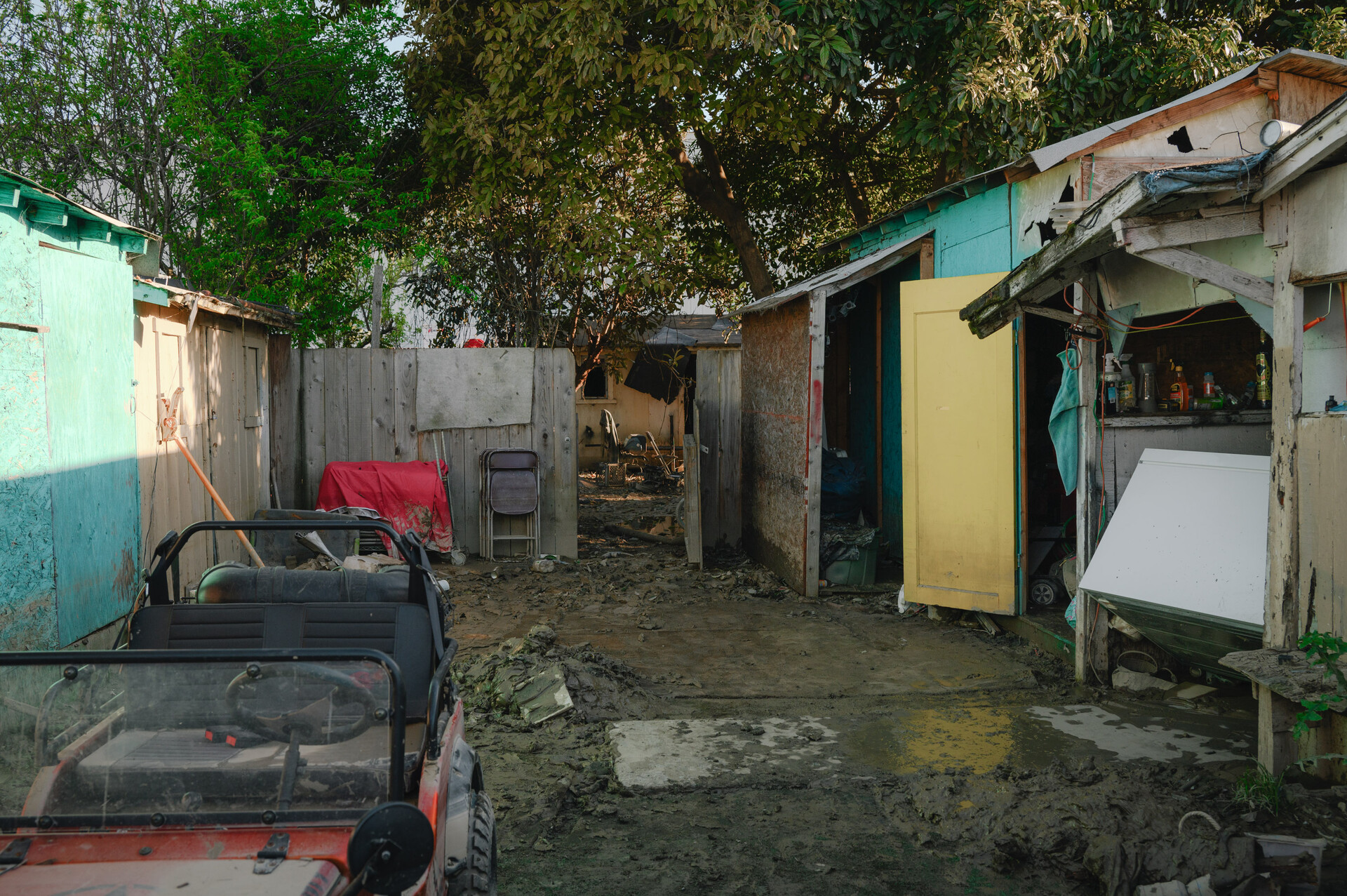
 Thick, foul-smelling mud coats the ground in Juan Escutia’s backyard in Pajaro on March 24, 2023. (Kori Suzuki/KQED)
Living in the shadow of an aging levee
For young people like Armando Alvarado, who now lives in the shadow of a broken levee, the climate crisis is all too real. A week after floodwaters covered Pajaro, the 22-year-old returned home to find his garage coated with a thick layer of sticky, putrid mud — even as the rest of the elevated home his family rents was unscathed.
But the wet mud in the garage ruined a number of family heirlooms, including his collection of red, white and black ostrich-leather ranchero boots.


