By comparing the spectrometer’s data with ground measurements, researchers were able to determine where flowers were blooming in the aerial images and create maps that show blooming patterns over time.
Researchers had never before used the instrument to monitor blooming vegetation for an entire growing season, collecting images each week, said David Schimel, a research scientist with NASA JPL.
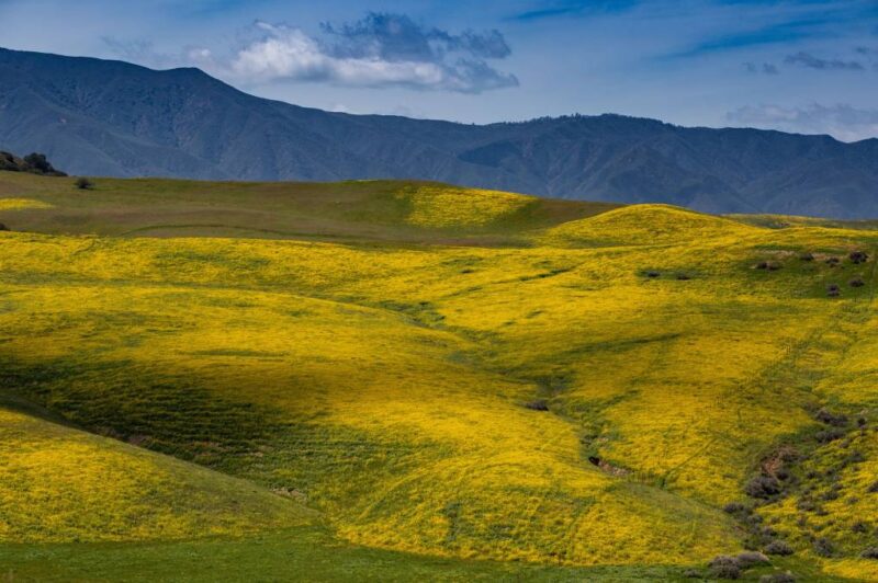
Flowers have a bigger impact on the landscape’s appearance in aerial images than the scientists expected. The team was able to differentiate between flowers, leaves and background cover with 97% accuracy and determine different flowering stages with 80% certainty.
Spectral imaging could be a game-changer for tracking blooms on a regional or even global scale — without needing to hike through every field.
A challenge was differentiating flower colors from leaves, soil and shadows. “Compared to other parts of a plant, flowers can be pretty ephemeral,” Angel said. “They may last only a few weeks.”
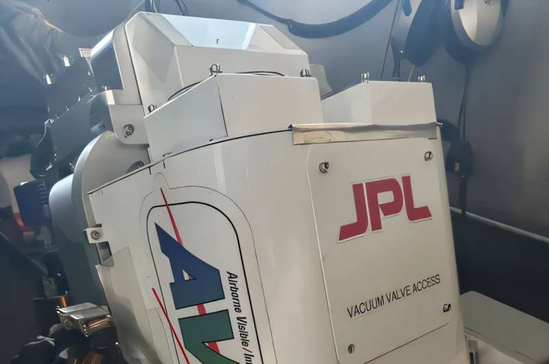 NASA’s AVIRIS sensors have been used to study wildfires, World Trade Center wreckage, and critical minerals, among numerous airborne missions over the years. AVIRIS-3 is seen here on a field campaign in Panama, where it helped analyze vegetation in many wavelengths of light not visible to human eyes. (Courtesy of NASA/Shawn Serbin)
Flowering plants, from crops to desert shrubs, synchronize their bloom cycles with seasonal changes in temperature, rainfall and daylight. However, these patterns are shifting due to climate change, and scientists are eager to track how rising temperatures impact plant life.
Flowers produce pigments that absorb and reflect light in unique ways. Spectrometers can detect these light signatures and identify plants based on their distinct chemical “fingerprints.” This technology has been used for decades to analyze planetary surfaces — including Earth — and is now proving valuable for monitoring plant life from above.
“These sensors are helping us to see what pollinators see,” Angel said, adding that pollinators like bees, birds or butterflies see through different spectral ranges than humans.
The implications extend far beyond wildflowers. Around 90% of land plants are flowering species, many of which are crucial to agriculture.
Understanding their bloom patterns could help farmers plan harvests and track crop development, assist conservationists in managing habitats and support climate scientists tracking changes over time.
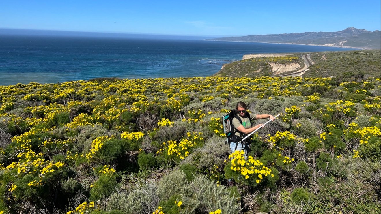 Researcher Ann Raiho measures sunlight interacting with yellow Coreopsis gigantea flowers during field work in the Jack and Laura Dangermond Preserve in California’s Santa Barbara County in 2022. (Courtesy of NASA/Yoseline Angel)
Angel and her team are now analyzing data from a spectrometer aboard the International Space Station, originally designed to map Earth’s desert minerals. By combining those images with environmental conditions, scientists hope to predict when and where massive super blooms — those rare, breathtaking explosions of desert flowers — will occur.
Beyond scientific research, the project has sparked excitement among citizen scientists. Angel, who follows wildflower updates through social media, believes public enthusiasm can complement NASA’s data collection.
“People can help us to observe and report flowers. If they see something like a bloom or super bloom happening, they can always help us to try to enhance our models and [contribute to] science,” Angel said.
Apps like GLOBE and iNaturalist let people be part of the science — by snapping photos and logging what plants or flowers they see, users help scientists study changes in nature and the environment over time.


